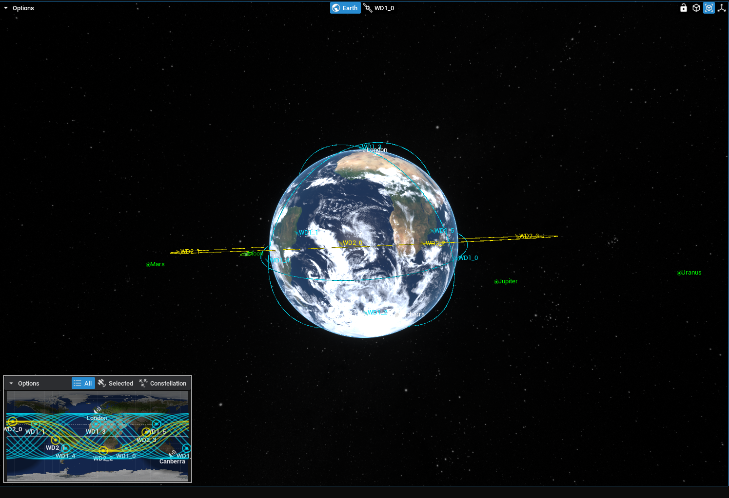
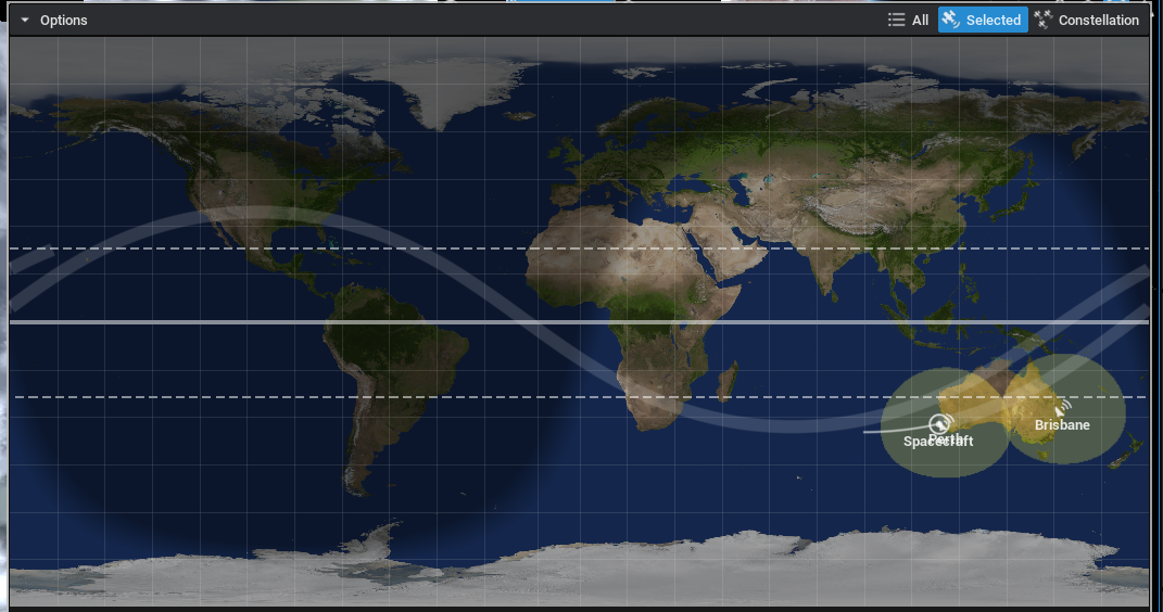
The map UI widget can display the location of spacecraft relative to the surface of the Earth (or other planets) using a geodetic conversion. The widget can display multiple spacecraft and perform simple predictions of the flight paths of spacecraft. An example is shown in the Orbits/Constellation/Demo_Constellation level.
NOTE
To expand the widget in Zendir Editor, click on the map image and it will open up in full view. Click again on the map to minimize the view back to the corner of the Viewport.
Adding the Widget
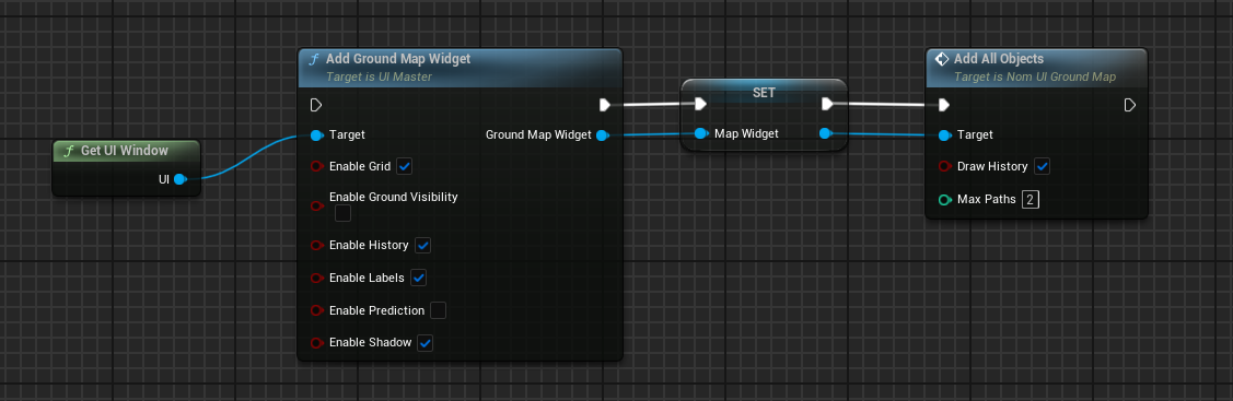
The map widget is added to the UI object. From Get UI Window call the Add Ground Map Widget node.
Enable Gridparameter will display geodetic grid lines every 15 degrees of latitude and longitude.Enable Labelsparameter will display the name of the spacecraft and ground station on the map. Disabling this parameter will only show the icon of the locations instead.Enable Ground Visibilityparameter will display the range of ground stations on the ground map if applicable.Enable Historyparameter will display lines of the path the spacecraft has taken.Enable Predictionparameter will display the spacecraft’s future path as lines in front of it’s icon.Enable Shadowparameter will display which parts of Earth is in darkness due to the day/night cycle.
Adding Objects
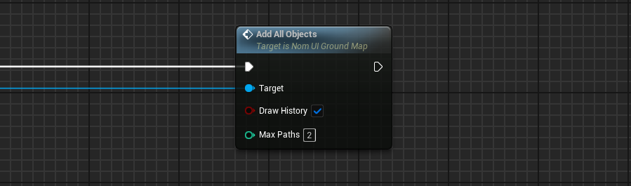
All objects in the simulation can be added into the ground map by calling Add All Objects. Add Spacecraft, Add Ground Object, Add Custom Track can be used to add specific objects into the ground map. If Draw History is enabled, the spacecraft’s historical locations will be tracked over the map. This will be tracked for the total number of orbits as defined in the parameter.
Orbit Prediction
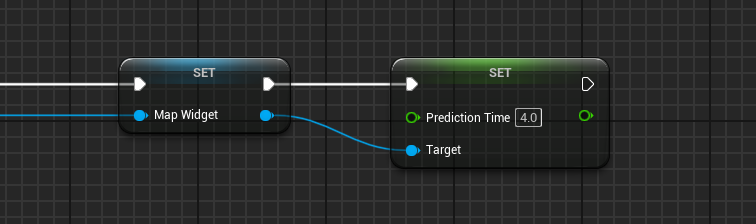
The map widget can predict the orbit of a spacecraft in the future for a specified amount of time. This is a crude approximation using a simple Keplerian orbit propagation system and does not make use of an RK4 integrator. As such, the propagation can be useful for determining the location of the spacecraft in the next orbit to the nearest degree of latitude and longitude but will be more inaccurate the further the time is away from the current time. The propagation time of the orbit can be configured by setting the Prediction Time on the Ground Map Widget. The default value is 4hr which is what is set on the system if the user does not specify a time.
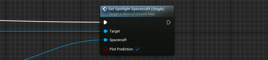
To start showing the propagation of a spacecraft, the spacecraft must be spotlighted. This can be done using the Set Spotlight Spacecraft (Single). This can be done at any point in the event graph and can be done during the level when playing. Spotlighted prediction paths are shown in the larger colour band with the colour of the spacecraft that is selected.
NOTE
Only one spacecraft can have its orbit predicted at any one time. This is to ensure that the simulation does not run slow. Orbit propagation is an expensive process and can slow down the simulation.
The spotlight can be disabled using the function on the UI widget to show all spacecraft: Show All Spacecraft. This will display all spacecraft around the current planet that is displayed in the UI map.
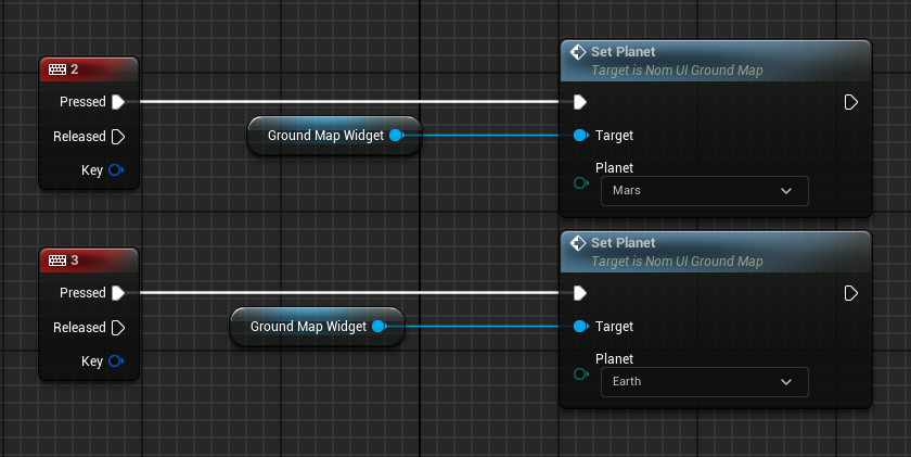
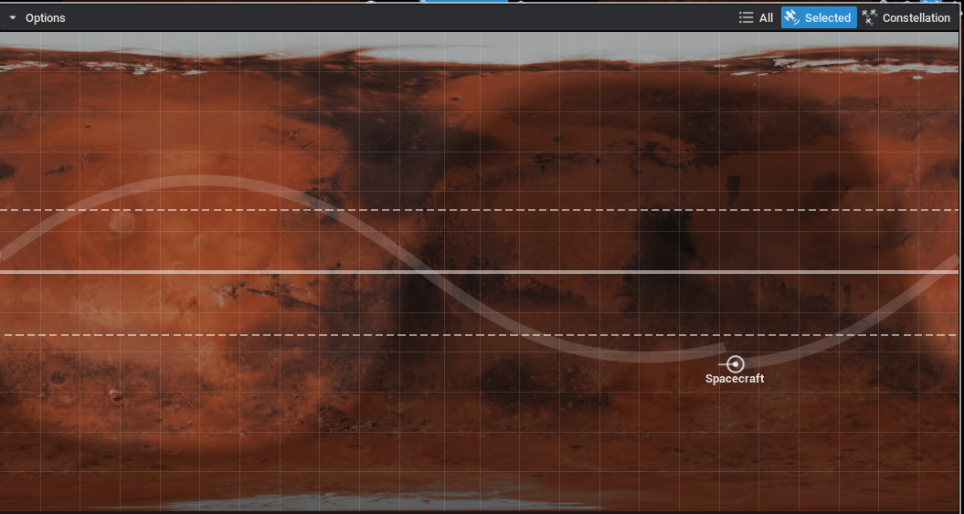
Multiple Planets
The map widget will show the spacecraft on a particular planet or body. In the constellation demo level, spacecraft are orbiting the Earth, Moon and Mars. To switch between the views to see the spacecraft orbiting the other bodies, the Set Planet function can be called, which will display all of the spacecraft around another planet.
This can be useful for seeing the ground map on multiple planets in one level.