
The Guidance Controller on the Commands page includes preprogrammed pointing modes. Pick a mode, fill in the fields it asks for, then click Apply Guidance.
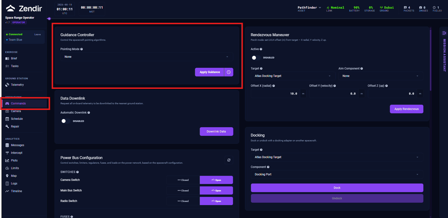
The mode list commonly includes None, Inertial, Sun, Velocity, Nadir, and Location. Some scenarios also expose Ground or Relative. Alignment uses a right-handed body frame. For most payloads the +Z axis is the principal pointing vector of interest.
Inertial Pointing
The spacecraft holds a fixed attitude relative to inertial space (typically referenced to the celestial sphere). It does not continuously track Earth or the orbital velocity vector. Use this for astronomy-style observations, calibration, or any activity that needs a stable inertial reference.
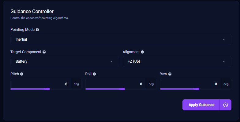
Typical fields:
- Target Component: which body axis or payload you are steering
- Alignment: which body axis direction to hold (for example +Z (Up))
- Pitch, Roll, Yaw: attitude offsets in degrees about the side-to-side, front-to-back, and vertical axes
Sun Pointing
The spacecraft points a chosen body axis toward the Sun. Typical uses are power-positive solar array pointing, thermal control, or Sun-tracking payloads.
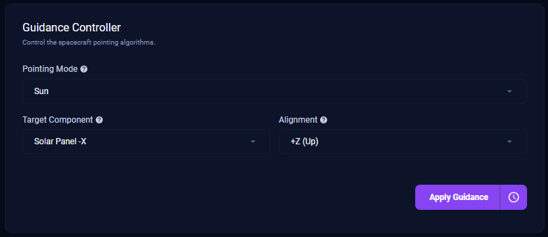
Typical fields: Target Component and Alignment.
Velocity Pointing
The spacecraft aligns a body axis with the orbital velocity vector (ram) or anti-velocity vector (wake). Use this when an instrument needs a forward-looking or ram-facing attitude.
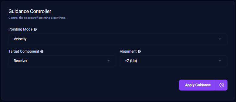
Typical fields: Target Component and Alignment.
Nadir Pointing
The spacecraft keeps a chosen axis pointed at the planet’s centre (local nadir). This is the standard Earth-observation attitude for surface imaging and planet-facing antennas. You can choose which celestial body to nadir-point at when the scenario allows it.
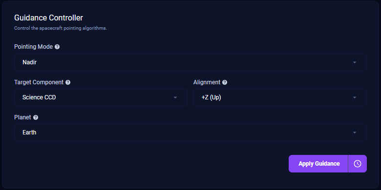
Typical fields: Target Component, Alignment, and Planet.
Ground Pointing
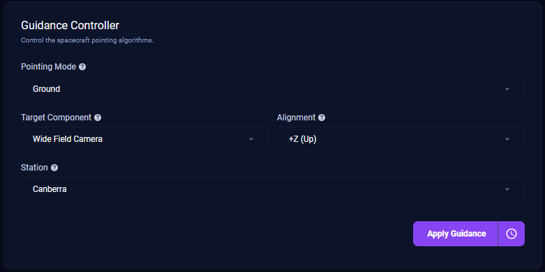
The spacecraft tracks a specific ground station location, continuously adjusting attitude as you pass overhead. Use this when you need the best geometry for a high-rate pass to a named station.
Location Pointing
The spacecraft holds a sensor line of sight on a latitude / longitude target even when you are not directly overhead. Use this for site-specific imaging or tracking a fixed ground point.
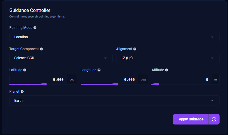
Typical fields: Target Component, Alignment, Latitude, Longitude, Altitude, and Planet.
Relative Pointing
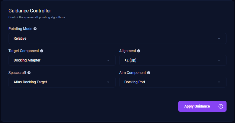
When other assets exist in the exercise, you may also see Relative mode. Point a chosen component toward another spacecraft (and a selected aim component on that vehicle). This is the attitude building block for proximity operations when the scenario enables it. A dedicated Relative screenshot was not captured in the latest live session.
Operator tips
- Always confirm the Target Component (which body axis / payload you are steering) before you apply guidance
- Pair pointing changes with Map so you know what the camera or antenna is about to see
- If guidance appears to do nothing, check link, schedule time, and whether you selected the correct spacecraft. See Troubleshooting