
Open Map under Analytics to see where your spacecraft is relative to the ground network. Use it to answer “where am I, where are they?”
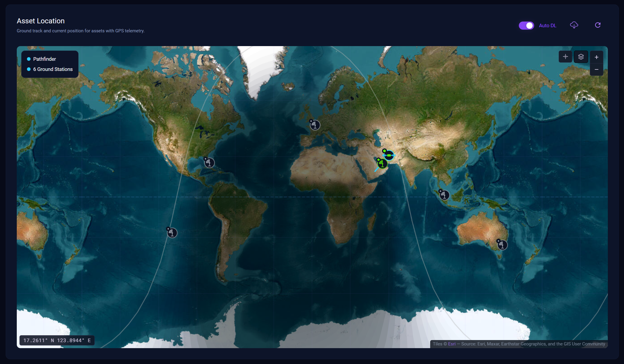
What the map shows
- Current position of your spacecraft (and other visible assets, depending on the scenario)
- Recent ground track
- Ground stations for the exercise
- Whether you are currently in view of a station (use this before captures and downlinks)
If you see NO LOCATION DATA, the Operator has not received GPS / position telemetry for the selected asset yet. Downlink, wait for the next ping, or confirm the spacecraft actually carries a GPS sensor in this scenario.
Working with the map
Typical uses during an exercise:
- Confirm you joined the right team asset and it is on the expected orbit
- Check you are over the imaging target before you capture
- Check you are in view of a ground station before you change radio settings or expect a fast downlink
The map does not send commands. For pointing and downlink, switch back to Commands.
Header controls on the map may include Auto DL, a manual downlink action, and refresh. Those are useful when you want position updates without leaving the page.